Posts

Showing posts from November, 2007

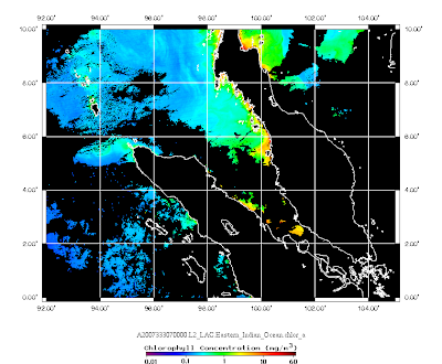
Malacca Straits Images! 29 Nov 2007

Image
High chlorophyll a starting to appear at northeastern Malacca Straits (5.5 N 99E). It indicate the beginning of the northeast monsoon driven upwelling. The upwelling at this area normally do not reflec clearly in the sea surface temperature.

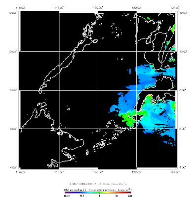
Sulu Sea Images! 29 Nov 2007

Image

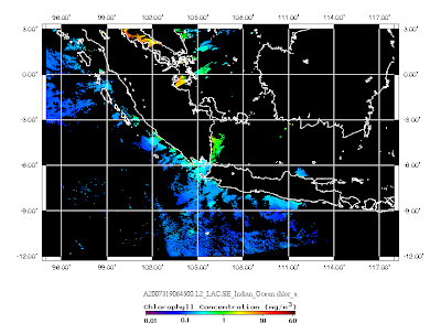
The End of IOD! Images on 29 Nov 2007

Image
Warmer sea surface temperature and low chlorophyll a was observed at Southern Java and Sumatra on 29 Nov 2007. It indicate the ending of Indian Ocean Dipole 2007. However, according to the seasonal climate prediction, the Southeast Asian region is expected to be infulenced by La Nina until 2008.

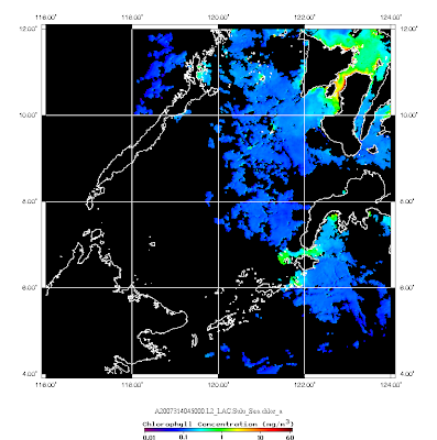
Sulu Images! 26 Nov 2007

Image

IOD Images! 25 Nov 2007

Image
The current MODIS Aqua images show that Indian Ocean Dipole 2007 almost ended. The sea surface temperature is getting warmer at Southern Sumatra and chlorophyll a is reducing.

Vietnam Images! 18 Nov 2007

Image

Vietnam Images! 17 Nov 2007

Image

IOD Images! 17 Nov 2007

Image

IOD Images! 15 Nov 2007

Image

Malacca Straits Images! 13 Nov 2007

Image

News! 071109 AN ERA OF EARTH OBSERVATIONS: LOOKING BACK AT 50 YEARS

AN ERA OF EARTH OBSERVATIONS: LOOKING BACK AT 50 YEARS Source: http://earthobservatory.nasa.gov/Newsroom/MediaAlerts/2007/2007110925922.html Since the launch of Sputnik I in 1957, thousands of satellites have been sent into space on missions to collect data about the Earth. Today, the ability to forecast weather, climate, and natural hazards depends critically on these satellite-based observations. Satellites have revolutionized how humans view and understand the home planet, helped address fundamental scientific questions, and enabled a plethora of applications with important societal benefits. Continued Earth observations from space will be required to address scientific and societal challenges of the future.Where will a developing hurricane make landfall? What is the status of the ozone layer? How much will sea level rise? No other single measurement platform has revolutionized the ability to address these and other fundamental Earth science questions as much as satellites orbiting
Vietnam Images! 12 Nov 2007

Image

Northern Borneo Images! 10 Nov 2007

Image

Sulu Images! 10 Nov 2007

Image