Posts

Showing posts from July, 2008

{News} 080731 Haze shrouds parts of Penang

Haze shrouds parts of Penang Jul 31, 2008, The Star GEORGE TOWN: Parts of Penang was temporarily shrouded in haze yesterday with visibility dipping to 1km in Butterworth and 6km in Bayan Lepas at 8am. A state meteorological department spokesman said the situation only improved in the afternoon with visibility at Butterworth and Bayan Lepas increasing to 7km and 8km respectively at 3pm. The visibility at Prai however dipped from 10km at 8am to 9km at 3pm. The spokesman said the haze was caused by dust particles trapped in water vapour, adding that Butterworth had always been worst-hit as it was an industrial area and had more suspended particles in the air. Hazy afternoon: The Penang Bridge seen from the Lebuhraya Bayan Lepas at 1pm Wednesday. The Air Pollutant Index (API) readings at the three monitoring stations in the state was moderate. API readings recorded at Universiti Sains Malaysia, Prai and Seberang Jaya were 55, 60 and 79 respectively at 11am, according to the Department of E

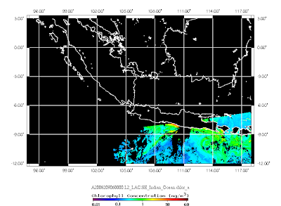
Sumatra and Java Satellite Images! 30 Jul 2008

Image

Malacca Straits Satellite Images! 29 Jul 2008

Image

Sumatra and Java Satellite Images! 29 Jul 2008

Image

{News} 080731 Haze hits Penang

Haze hits Penang Jul 31, 2008, BERNAMA PENANG, THURS: Penang was overcome by haze today, with three areas experiencing poor visibility for between two and six kilometres. The haze is believed to have originated from open burning in Sumatra, Indonesia.According to a spokesman of the Penang Meteorological Department, the situation was worsened with suspended materials in the atmosphere.“We believe the haze is caused by open burning in Sumatra as satellite images have indicated 150 hot spots there.“Due to the dry weather, the haze is expected to last for several days in the northern part of the peninsula. “Nevertheless, the situation is not alarming as it will change for the better when there are strong winds and heavy downpour,” he told Bernama.As of 11am, the Air Pollutant Index (API) in Seberang Jaya is 79, while the visibility distance is two kilometres.In Prai, the API is 53 while the visibility is six kilometres while at Universiti Sains Malaysia, it is 53, with visibity at five kil

Sumatra and Java Satellite Images! 28 Jul 2008

Image

Sumatra and Java Satellite Images! 28 Jul 2008

Image

Sumatra and Java Satellite Images! 27 Jul 2008

Image

{News} 080728 New insights into what's driving Australia's rainfall

New insights into what's driving Australia's rainfall Fairfax Digital 28/07/2008 4:45:00 PM Australian farmers are one step closer to having regionally-relevant climate forecasting products as a result of new research into Australia's regional climate drivers. The findings offer new insights into the relationship between large-scale climate drivers and rainfall patterns in Australia's major agricultural regions. The research has been conducted by the Centre for Australian Weather and Climate Research in partnership between CSIRO and the Bureau of Meteorology. "Simply learning that the influence of the Indian Ocean Dipole is mainly confined to the second half of the calendar year and that it particularly affects the agricultural regions of southern Australia provides useful information for farm managers," said Dr Mike Pook from the Centre for Australian Weather and Climate Research. "If producers see the positive phase of the Indian Ocean Dipole developin

Update 080726! Latest Dipole Mode Index!

Image
Alert! DMI Increased Intensively after a drop! Will it repeat the 2006 situation? Dipole Mode Index (DMI) from OOPC, access on Jul 26, 2008( http://ioc3.unesco.org/oopc/state_of_the_ocean/sur/ind/dmi.php ) The reduction of DMI since June had given a release to the communities who was concern about this phenomena in Indian Ocean. However, the sharp increase since July is a worrying situation. Will it cause the repeating of the natural disasters around Indian Ocean region like in 2006?

{Announcement} 080723 ENSO Wrap-Up

ENSO Wrap-Up BOM, Australia Summary: Tropical Pacific remains neutral and continues to warm Neutral ENSO conditions continue to prevail across the tropical Pacific. Over the past two weeks most indicators of ENSO have remained close to normal. The Trade Winds have strengthened in the west but remain close to normal in the central and eastern equatorial Pacific Ocean. Cloudiness near the dateline has been near-normal and the SOI has also remained in the neutral range since May. Sea surface temperatures have continued to warm further across the entire basin. Climate model forecasts of ENSO show that neutral conditions are likely to continue thoughout 2008. Most models show some warming in the coming season. None suggest a redevelopment of a La Niña and only a minority predict an El Niño developing. As winter is a period of relatively high predictability the persistence of neutral conditions is considered the most likely scenario in the coming months. However, there is still a small chanc

Northern Borneo Satellite Image! 25 Jul 2008

Image

Sumatra and Java Satellite Images! 24 Jul 2008

Image

Sumatra and Java Satellite Images! 23 Jul 2008

Image

Vietnam Satellite Images! 22 Jul 2008

Image

Sumatra and Java Satellite Images! 22 Jul 2008

Image