Posts

Showing posts with the label Indian Ocean Dipole

Understanding the Indian Ocean Dipole

Image
BOM has prepared a wonderful video to introduce the event of Indian Ocean Dipole

{News} 090513! All dry on the western front

All dry on the western front The Australian, May 13, 2009 IT has been labelled the cousin of El Nino, the Indian Ocean's equivalent of the climatic engine in the Pacific that drives the cycle of droughts and floods in Australia's southeast. But when CSIRO scientist Wenju Cai factored the Indian Ocean Dipole into his climate model, he found that this little cousin could contribute to droughts. It could depress spring rainfall by up to 30 per cent in Australia's southeast, a region encompassing the nation's food bowl, the southern Murray-Darling Basin. And with global warming set to increase the frequency of dipole events, Australia was likely to get even bigger climatic shocks than previously thought, the computer simulations suggested. Much of Australia's climatological research has focused so far on the Pacific Ocean's El Nino-Southern Oscillation pattern. Droughts hit when the eastern Pacific warms, weakening the eastern trade winds that bear rain to southeast...
NASA Study Says Climate Adds Fuel to Asian Wildfire Emissions NASA In the last decade, Asian farmers have cleared tens of thousands of square miles of forests to accommodate the world’s growing demand for palm oil, an increasingly popular food ingredient. Ancient peatlands have been drained and lush tropical forests have been cut down. As a result, the landscape of equatorial Asia now lies vulnerable to fires, which are growing more frequent and having a serious impact on the air as well as the land.A team of NASA-sponsored researchers have used satellites to make the first series of estimates of carbon dioxide (CO2) emitted from these fires -- both wildfires and fires started by people -- in Malaysia, Indonesia, Borneo, and Papua New Guinea. They are now working to understand how climate influences the spread and intensity of the fires.Using data from a carbon-detecting NASA satellite and computer models, the researchers found that seasonal fires from 2000 to 2006 doubled the amount o...

{News} 090324! Thundershowers seen dousing mercury in north

Thundershowers seen dousing mercury in north Vinson Kurian Thiruvananthapuram, March 24 Maximum temperatures over northwest India are expected to come down by 2 to 4 degree Celsius during the next three days as thunderstorms continue to flare up eastward from the region. The maximum temperatures are currently near normal over most parts of the country but the minimum temperatures have been hovering above normal by 2 to 5 degree Celsius over parts of northwest and central India. The India Meteorological Department (IMD) said in its update on Tuesday that one such weather-maker system lay anchored over Jammu and Kashmir. On Tuesday, a weather-setting trough extended from Lakshadweep area to west Madhya Pradesh through south Konkan, Goa and Madhya Maharashtra with an embedded cyclonic circulation over west Madhya Pradesh. Another cyclonic circulation hovered over southwest Rajasthan. MOISTURE FEED The cool westerlies to northwesterlies packing the southward dipping western disturbances an...

{News} 090325! Bushfire origins lie in Indian Ocean

Bushfire origins lie in Indian Ocean Wednesday, 25 March 2009 Dani Cooper ABC A weather pattern centred on the Indian Ocean may provide an early warning system for major bushfires in southern Australia, climate experts say. Dr Wenju Cai and Tim Cowan, of CSIRO 's Marine and Atmospheric Research have uncovered a link between the Indian Ocean Dipole (IOD) and Victoria's killer bushfires. Cai will tell the Greenhouse 2009 conference today that 11 of 16 major bushfires in Victoria since 1950 have been preceded by what is known as a positive IOD event. He says, "an unprecedented" three consecutive positive IOD events preceeded February's devastating Black Saturday bushfires. The IOD refers to temperature fluctuations in the east and western Indian Ocean. In its negative phase, the IOD brings cool water to the ocean west of Australia and warm water to the north, leading to winds that bring rain-bearing air over the continent. In the positive phase, water temperatures a...

{News} 090322! Model forecasts indicate normal monsoon this year

Model forecasts indicate normal monsoon this year Vinson Kurian Thiruvananthapuram, March 22 The International Research Institute (IRI) for Climate and Society at Columbia University has forecast normal to slightly above normal monsoon for India during June to September this year. This would be preceded by a spectacular pre-monsoon season, especially towards the East and northeast of the country, a comparative study of predictions by IRI and other models suggested. The IRI has also predicted above normal temperatures for North India during the April-May-June quarter, which is crucial for ‘setting up the monsoon’. The land-ocean temperature differential is the driving force behind the monsoon. BUSY NORTHEAST The May-June-July quarter witnesses the onset of monsoon orchestrated by the Arabian Sea arm along the Southwest coast and the Bay of Bengal over the northeastern States. IRI forecasts indicate a busy onset phase over the northeast, coming close on the heels a successful pre-monsoon...

{News}090205! Indian Ocean is drought culprit

Indian Ocean is drought culprit Ben Cubby, Environment ReporterFebruary 5, 2009 THE main cause of our droughts and flooding rains has been traced to the waters of the Indian Ocean, according to a new report from the University of NSW which could overturn decades of weather research. The study shows that the cycle of El Nino and La Nina events, which have long been thought to play a major role in south-east Australia's weather patterns, are in fact less important than the Indian Ocean. It is likely to have major implications for predicting rainfall in the Murray-Darling region - still in the grip of the most severe drought on record - by giving farmers tip-offs about rainfall increases six months in advance. The current Indian Ocean warming pattern is unprecedented and probably related to climate change, researchers say. The report found that a phenomenon known as the Indian Ocean dipole plays a dominant role in determining temperature and rainfall in south-east Australia. It examin...

{News} Atmospheric scientists trace the human role in Indonesian forest fires

Atmospheric scientists trace the human role in Indonesian forest fires TORONTO, ON – Severe fires in Indonesia – responsible for some of the worst air quality conditions worldwide – are linked not only to drought, but also to changes in land use and population density, according to a new study in Nature Geoscience led by Robert Field of the University of Toronto. "During the late 1970s, Indonesian Borneo changed from being highly fire-resistant to highly fire-prone during drought years, marking the period when one of the world's great tropical forests became one of the world's largest sources of pollution," says Field, a PhD student of atmospheric physics. "Ultimately, this abrupt transition can be attributed to rapid increases in deforestation and population growth. The resulting occurrences of haze currently rank among the world's worst air pollution episodes, and are a singularly large source of ...
Pacific indicators point to la nina: bureau December 23, 2008, Weekly Times A CONTINUED cooling of the equatorial Pacific in the past two weeks raises the possibility of indicators reaching levels of a la nina, often associated with above-average rainfall in Australia, the Bureau of Meteorlogy says. If a la nina develops, summer crops such as sorghum and cotton in northeast Australia might experience several rainfall events in the coming months, potentially boosting production. Already, these cropping areas in northern New South Wales and southern Queensland received above-average November rainfall. "Given current conditions and recent trends, the development of a la nina during the southern summer can't be ruled out. However, the majority of climate models forecast neutral conditions, with a cooler than normal Pacific, during the first quarter of 2009," the bureau said in a regular review of Pacific conditions. The bureau also cited persistently stronger than normal tra...

{News} 081125! Bay depression may intensify, to cross TN coast

Bay depression may intensify, to cross TN coast The Hindu Business Line, Nov 25, 2008 Vinson Kurian Thiruvananthapuram, Nov. 25 The well-marked low-pressure area over north Sri Lanka and adjoining southwest Bay of Bengal has concentrated into a depression and lay centred 200 km southeast of Pamban and about 300 km south-southeast of Nagapattinam on Tuesday afternoon. India Meteorological Department (IMD) expected the system to intensify further and move slowly in a northwesterly direction and cross Tamil Nadu coast by Wednesday night. International models seemed to delay the landfall until Thursday along the Pattukottai-Vedaranyam belt. HEAVY RAINS Heavy to very heavy falls and isolated extremely heavy falls are likely over coastal Tamil Nadu during the next two days. Isolated heavy to very heavy falls are also likely over interior Tamil Nadu and Kerala during the same period. Squally winds speed reaching 45-55 km/hr gusting to 65 km/hr are likely along and off the Tamil Nadu and Pudu...

{Paper} 081116! Recent intensification of tropical climate variability in the Indian Ocean

Recent intensification of tropical climate variability in the Indian Ocean Nature Geoscience Published online: 16 November 2008 doi:10.1038/ngeo357 Nerilie J. Abram 1 , 2 , Michael K. Gagan 1 , Julia E. Cole 3 , Wahyoe S. Hantoro 4 & Manfred Mudelsee 5 The interplay of the El Niño Southern Oscillation, Asian monsoon and Indian Ocean Dipole (IOD) 1, 2, 3 drives climatic extremes in and around the Indian Ocean. Historical 4, 5 and proxy 6, 7, 8, 9 records reveal changes in the behaviour of the El Niño Southern Oscillation and the Asian monsoon over recent decades 10, 11, 12 . However, reliable instrumental records of the IOD cover only the past 50 years 1, 3 , and there is no consensus on long-term variability of the IOD or its possible response to greenhouse gas forcing 13 . Here we use a suite of coral oxygen-isotope records to reconstruct a basin-wide index of IOD behaviour since AD 1846. Our record reveals an increase in the frequency and strength of IOD events during the tw...

{News} 081117! Coral study points to more harsh droughts

Coral study points to more harsh droughts BY NYSSA SKILTON 17/11/2008 8:52:00 AM, The Canberra Times New coral records have revealed Australia is likely to experience more frequent and intense droughts. Scientists studying the tropical weather patterns stored in corals have discovered climate variability in the Indian Ocean has intensified during the 20th century. This suggests Australia and the region can expect less rain while eastern Africa gets wetter. An international research team, led by the Australian National University, analysed corals from tropical waters north-east of Australia to build a picture of climate change going back to 1846. Their findings are published in the journal Nature Geoscience, available online today. To date, reliable records of the Indian Ocean Dipole a climate phenomenon similar to El Nino go back about 50 years. Palaeoclimatologist Mike Gagan, of the ANU's Research School of Earth Sciences, said the researchers' techniques allowed them to analy...

{News} 081117! Droughts to become more frequent, severe: researchers

Droughts to become more frequent, severe: researchers ABC News, Mon Nov 17, 2008 Canberra scientists say they have proven that the world's climate is changing faster than ever before. The international research team drilled core samples from living corals off the Indonesian coast and found an increased frequency in the weather phenomenon known as the "Indian Ocean Dipole". Like the El Nino weather effect, the Indian Ocean Dipole has a dramatic impact on the Australian climate, and can cause severe droughts. Australian National University researcher Dr Mike Gagan says his coral samples show the dipole is occurring more regularly and that is changing Australian weather patterns. "There's going to be not only more propensity for drought, there's going to be more variability," he said. "If you get a dipole event superimposed onto an El Nino event, what may be a moderate El Nino event turns out to be a very strong drought." Dr Gagan says the Dipole ...

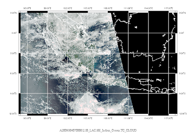
Sumatra and Java Satellite Images! 30 Oct 2008

Image

{News} 081031! Drought woes to continue: Jamstec

Drought woes to continue: Jamstec Weekly Times, October 31, 2008 BLEAK is the only way to describe Japanese forecasters' latest outlook for southeast Australia. "Large parts of Australia will still suffer from the long-lasting drought (until) the end of this year," according to Japan's Frontier Research Center for Global Change, Jamstec . Jamstec senior scientist Jing-Jia Luo said the group's Sintex computer model showed conditions would remain dry until January in southern Australia. "Early next year, good rain might occur in association with the demise of IOD (Indian Ocean Dipole) and weak cooling in the central equatorial Pacific," Mr Jing-Jia said. The Jamstec team, led by Prof Toshio Yamagata, has predicted the last three positive IOD events. The group's most accurate modelling is based on pooled three-month outlooks across the Pacific and Indian oceans. The Jamstec team produces monthly forecasts that show southeast Australia will experience a ...

{News} 081029! Models raise the mercury

Models raise the mercury 29/10/2008 9:15:00 AM, FairFax Digital CENTRAL Victoria is bracing for another hot summer, with the Bureau of Meteorology's latest outlook indicating higher than average temperatures through to January. Higher daytime and night-time temperatures look set to exacerbate an already dry spring and cause more water losses through evaporation. The latest climatic outlook based on modelling of ocean temperatures shows a probability of up to 70 per cent that daytime temperatures will exceed the median from November to January. The probability in relation to night-time temperatures is as high as 80 per cent. However, the silver lining is that rainfall outlooks don't show any strong tendency to be below or above average. Even average rain of about 110mm over the next three months would be a blessing. The two-month spring rainfall total in Bendigo is only 15mm, so it is tracking to be one of the worst on record. Climatologist Robyn Gardiner said the strongest infl...

{Annoucement} 081008! ENSO Wrap-up

ENSO Wrap-up BOM, Oct 8, 2008 Summary: Neutral ENSO conditions to continue The overall state of the climate in the Pacific Basin remains neutral with respect to ENSO. The eastern tropical Pacific Ocean has shown further cooling over the past fortnight, with surface temperatures now close to their long-term average. Also, recent cooling in the subsurface indicates the possibility of a further surface cooling over the coming weeks, especially in the eastern Pacific. This cooling has been largely driven by stronger than normal trade winds over the central and western equatorial Pacific during September. The SOI, although slightly weaker than two weeks ago, remains positive at +10. Given current conditions and trends in the equatorial Pacific there is now little potential for an El Niño event to occur in 2008. Historically, there is a strong tendency for the phase of ENSO to remain constant through the southern spring; therefore a switch to La Niña conditions is also very unlikely. This is...

{News} 081015! Climate's three-headed dog

Climate's three-headed dog MATTHEW CAWOOD Farmonline, 15/10/2008 2:10:00 PM There's a "three-headed dog" savaging Australia's climate, according to CSIRO scientist Dr Wenju Cai, and two of the heads are eating away at rainfall in southern Australia. The three climate influences referred to by Dr Cai are El Nino, the Southern Annullar Mode, and the Indian Ocean Dipole. All are driven by ocean temperatures, and all are being intensified, to Australia's disadvantage, by global warming. El Nino, driven by temperatures in the Pacific Ocean, is well studied and has had fairly predictable consequences for mid-latitude eastern Australia. The other two influences are less well known, but Dr Cai said there is growing evidence that their fluxes are behind the drying-out of southern Australia. One, Southern Annular Mode (SAM), appears to be driving rain-bearing winter fronts progressively out into the Southern Ocean. To the west, the Indian Ocean Dipole (IOD) is blocking...

Sumatra and Java Satellite Images! 19 Oct 2008

Image

Sumatra and Java Satellite Images! 14 Oct 2008

Image